VCUB
VCUB’S MISSION
Using its pioneering technology, Embraer integrates space systems and develops satellites, remote sensing products and services, satellite telecommunications and SAR aerial surveys in the X and P Bands.
The company operates in this segment through its subsidiary company Visiona Space Technology.

Sensor
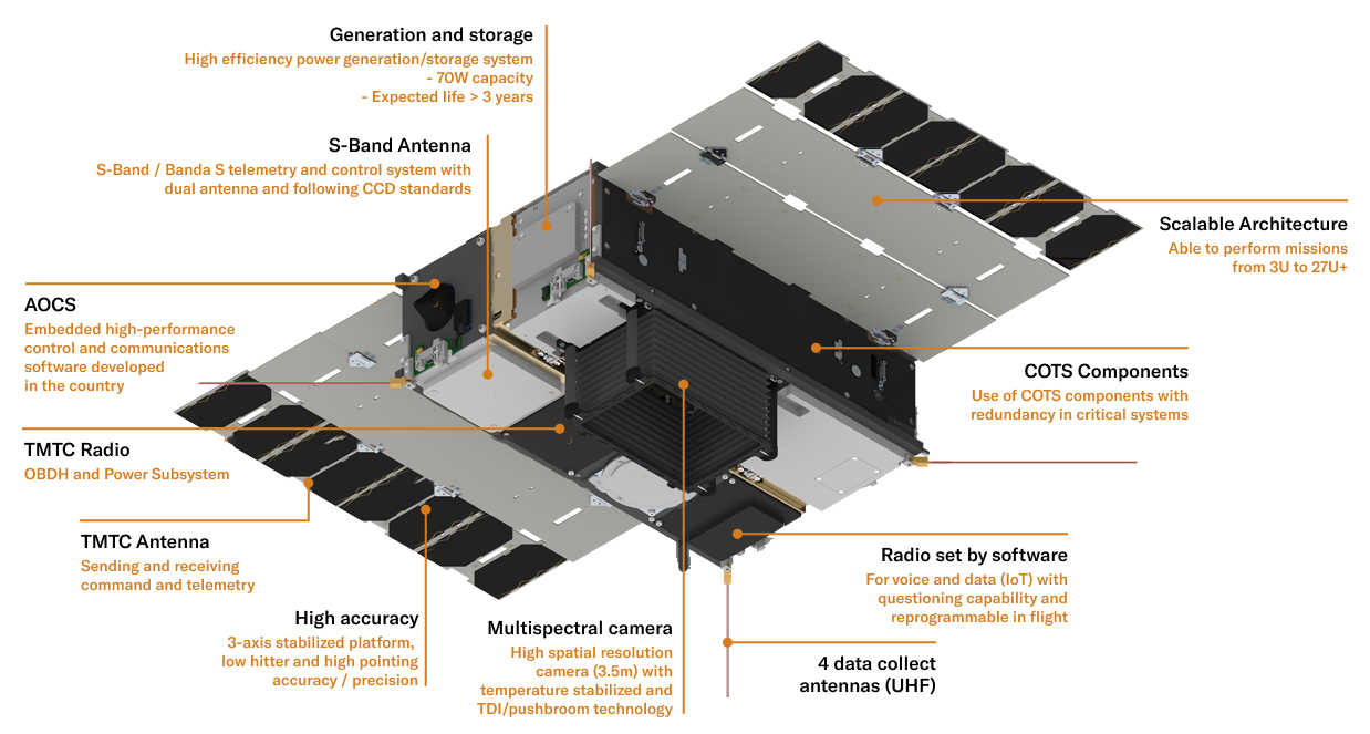
The satellite is equipped with a high-resolution space camera capable collecting radiometric and geometric pictures with quality exceeding market standards, making it ideal for taking for agricultural and environmental applications.
Software-defined radio
VCUB is also equipped with a UHF data collection system powered by software-defined radio. Its architecture is extremely flexible, and the system is driven initially for collecting hydrological and meteorological data, but could also be dated post-launch to include other IoT applications as needed.
AOCS
In October 2018, Visiona announced it completed the development of its Altitude and Orbit Control System (AOCS), which is responsible for satellite navigation, pointing, and control. This unique system is what allows a satellite, for example, to accurately point its camera to where images need to be collected or activate its propulsion mechanisms to correct its desired orbit.
AOCS System Features

OBDH
On-Board Data Handling (OBDH) is the satellite’s primary management and command software. As the satellite’s “brain”, it’s responsible.
VCUB’s Unique Features
- Architecture similar to large-size satellites
- High-performance pointing
system with national technology - Modular flight software provided
for operational missions - Two payloads: high-resolution optic
camera and IoT with software-defined
radio - Off-nadir image acquisition
- Par-stereoscopic image acquisition
- Enhanced data collection via PCDs
- In-flight radio software updates
